MBTA Upzone+
Collaborators: Juan Atehortua Paredes, Chenan Shen, Yining Bei
6.C85 Final Project
Abstract
The "MBTA Upzone+" project offers an innovative interactive tool designed to visualize and explore the implications of the Massachusetts Bay Transportation Authority (MBTA) Communities Act, which aims to mitigate housing shortages by promoting multi-family zoning near transit stations. Focusing on the town of Milton, MA, the project aims to provide a comprehensive view of potential upzoning impacts.
Background
Problem Statement
The MBTA Communities Act is designed to address the housing shortage in Massachusetts by mandating the creation of zoning districts for multi-family housing in communities served by the Massachusetts Bay Transportation Authority.
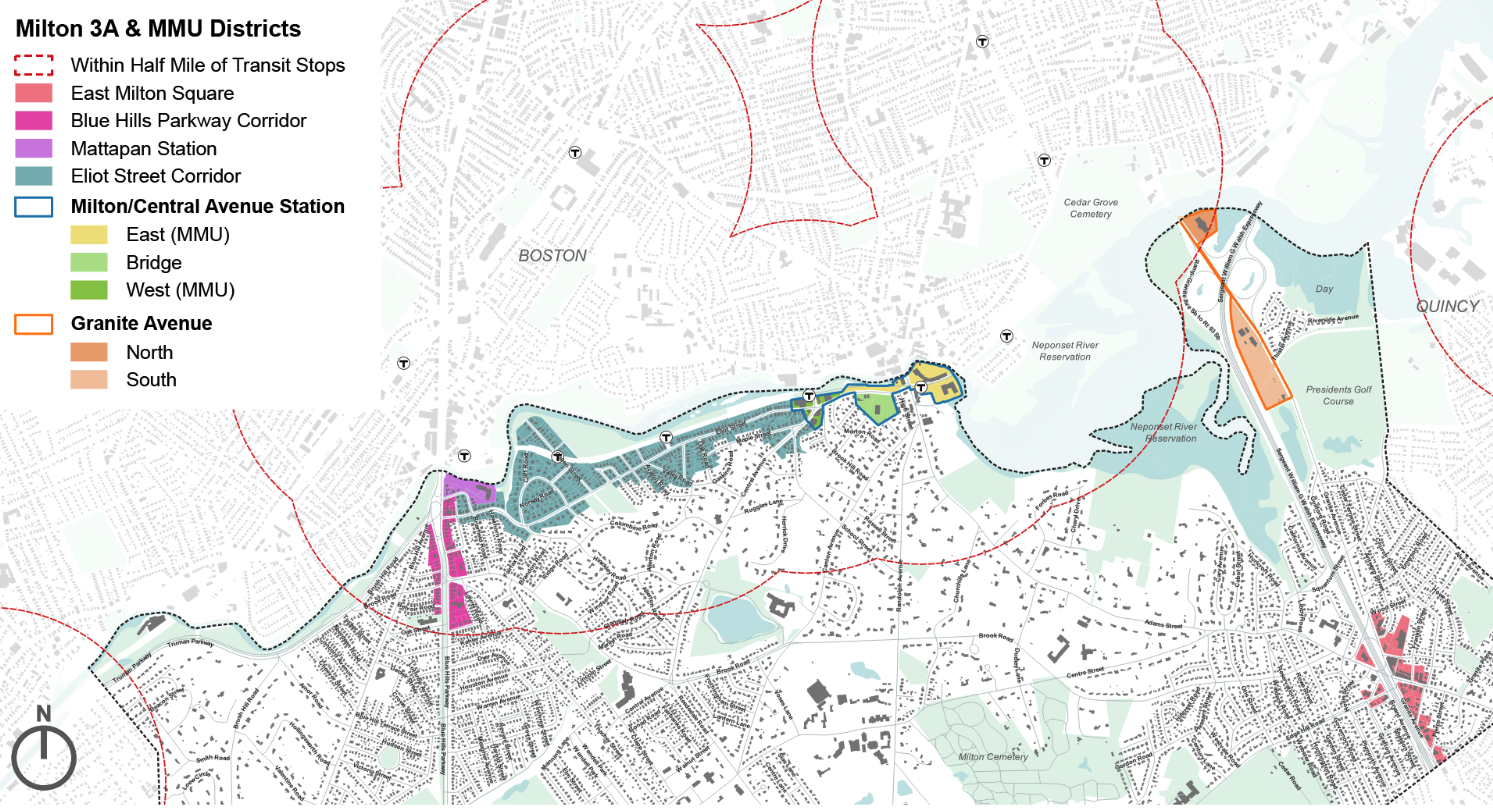
However, Milton has expressed resistance to this act. This project expands on the upzone plan originally proposed by Milton, incorporating various data sources and interactive elements to enhance the tool’s capability to deliver comprehensive information.
About MBTA Communities ACT
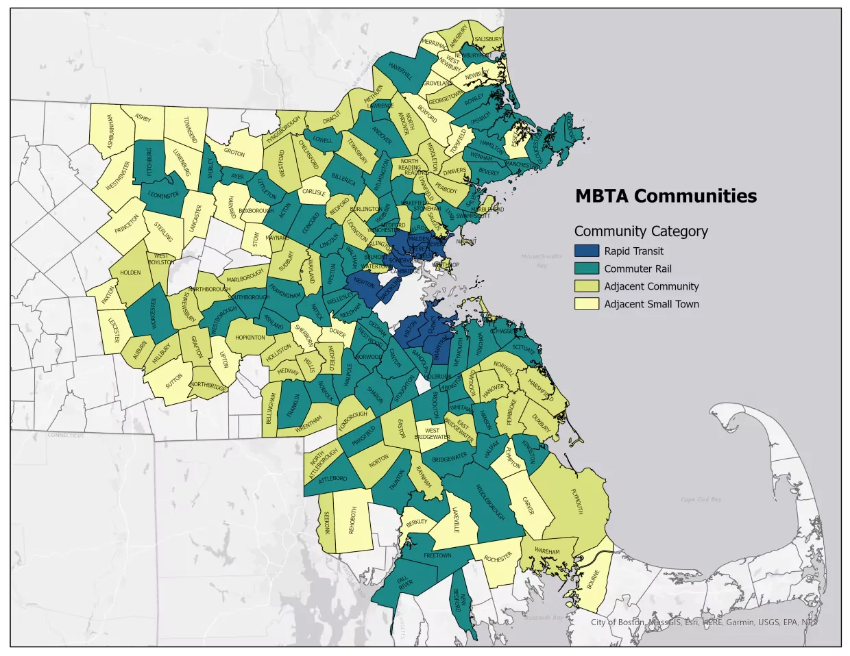
"MBTA communities" are 65 cities and towns that host MBTA service. An MBTA community shall have at least one zoning district of reasonable size in which multi-family housing is permitted as of right.
Design Decisions
Decision 1: Scrolly-Telling Intro Page
Our goal was to create a seamless and engaging user experience through simple scrolling. Visual elements are incorporated into each section to keep the content light and digestible.
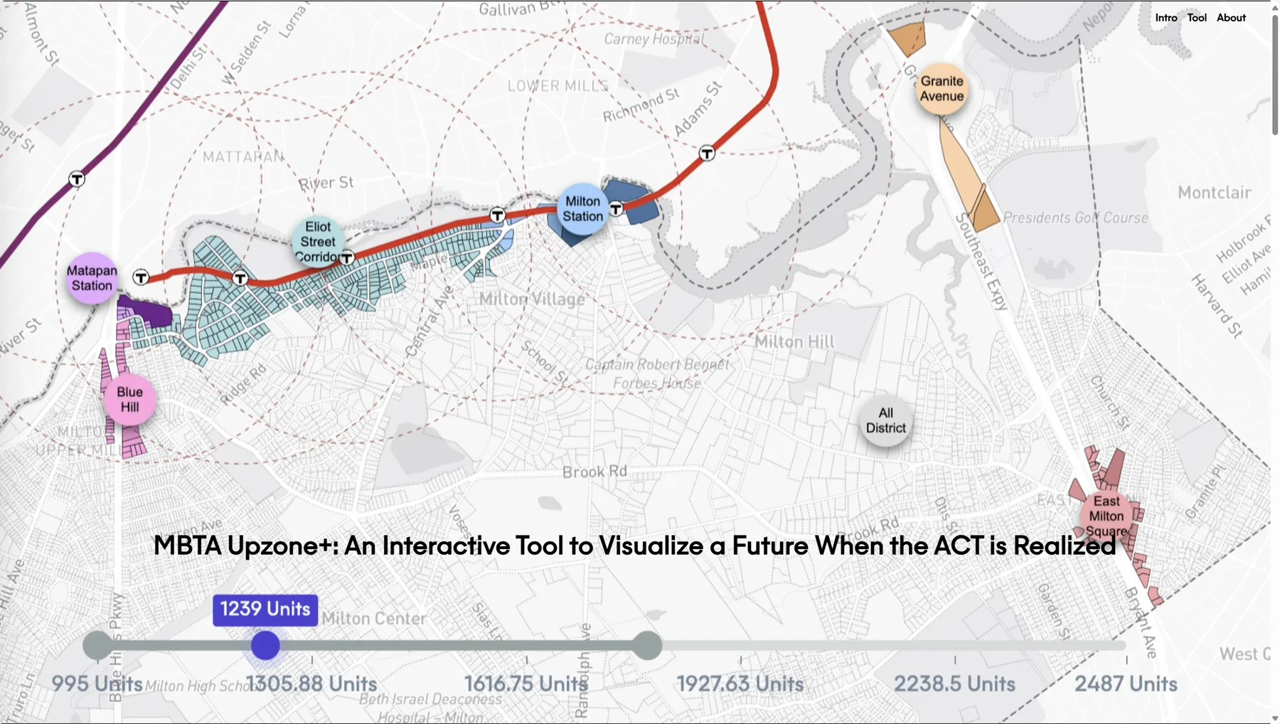
Decision 2: Slider
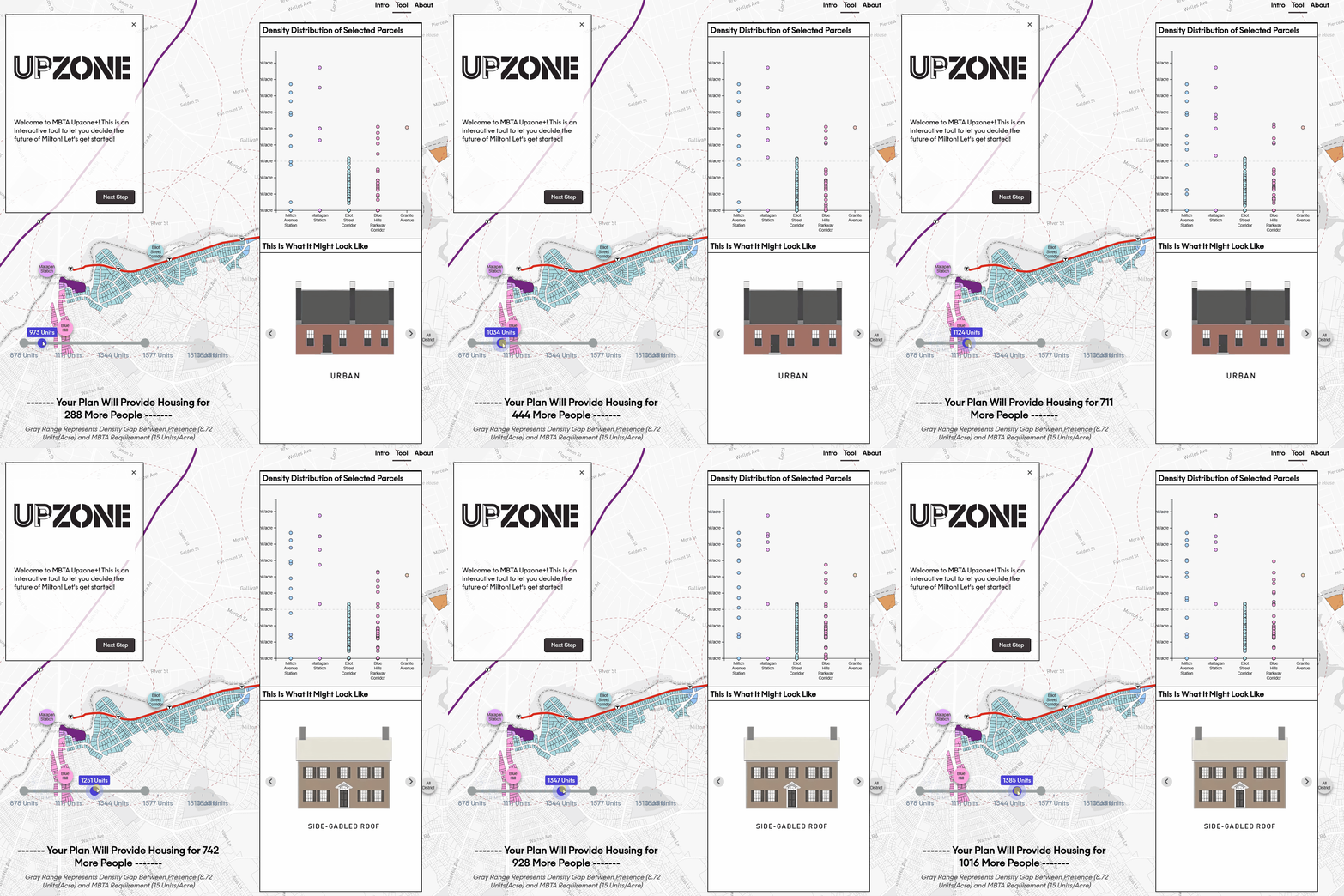
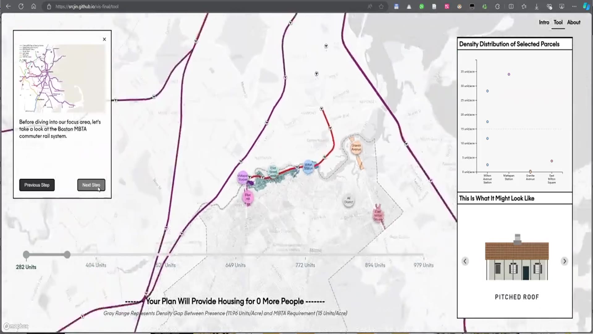
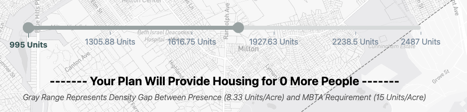
The slider allows users to adjust the number of units on each selected parcel and provides detailed information about those parcels, highlighting the density gap.
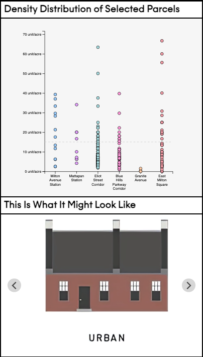
Decision 3: Side Panel
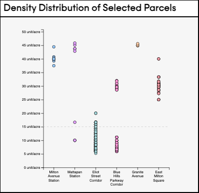
The side panel displays the distribution of each selected parcel's density according to each sub-district, integrating visual representations of building types.
Decision 4: Transit View
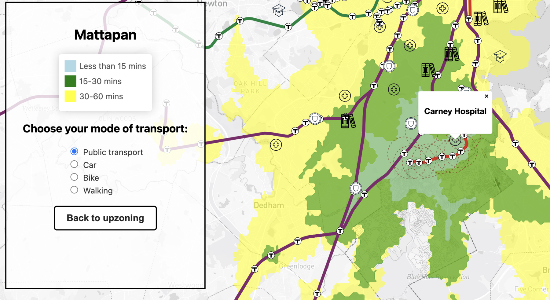
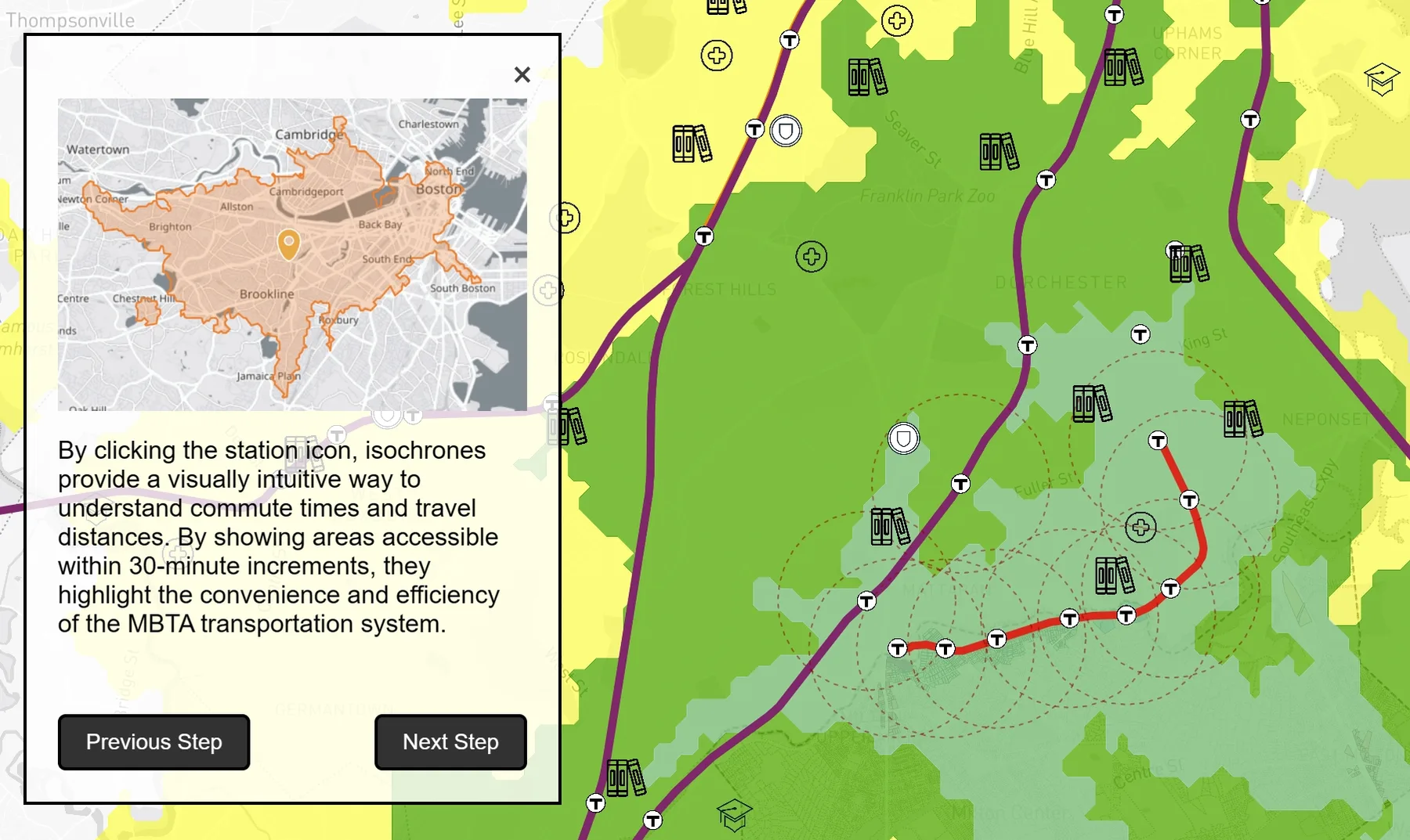
Clicking on any station shows a "transit view" visualization, including POIs and 15, 30, and 60-minute isochrones from the station.
Decision 5: Interactive Tutorial
A vibrant, step-by-step journey to empower new users to effectively navigate and utilize the tool.
Data Analysis
We focus mainly on Milton and visualize the upzoning household-job dynamics in relation to public transport commute time using the US Census LODES Dataset.
Result 1: Housing Crisis in Milton
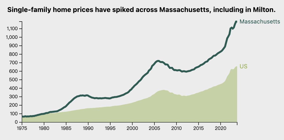
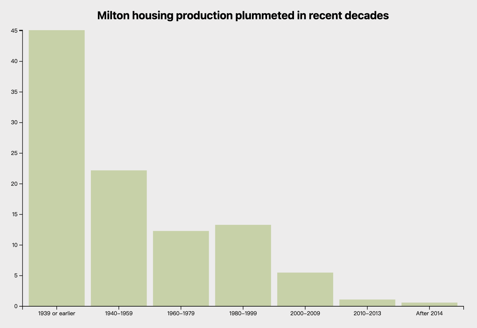
Prices in Massachusetts have escalated to nearly double the national average. In Milton, new housing development has sharply declined since 1980.
Result 2: Feasibility
The tool's analysis highlights that the upzone plan is highly feasible. Many parcels already exceed the required density, suggesting upzoning won't disrupt district character.